Description
Background:
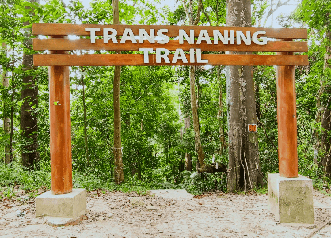
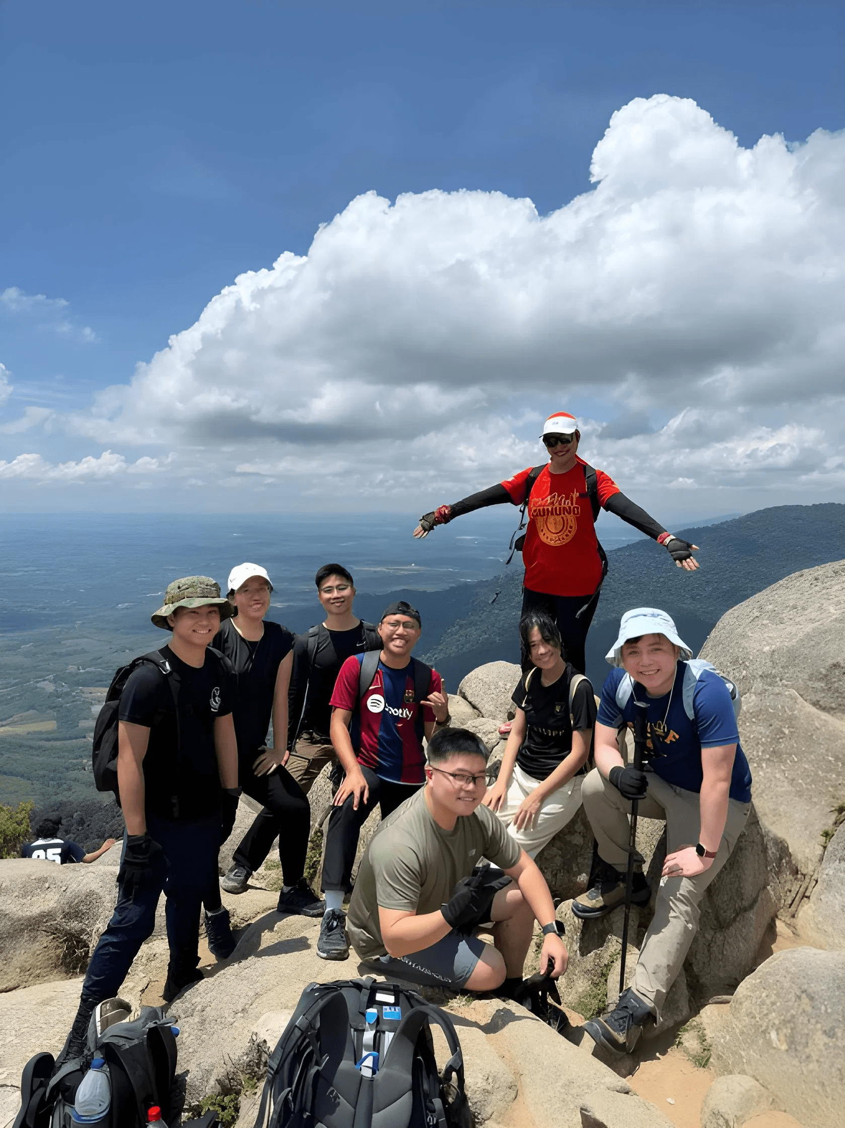
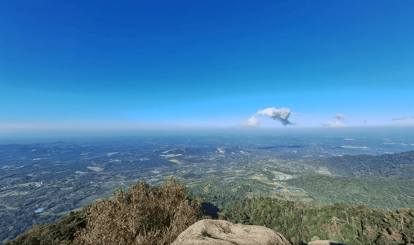
This trek is a test of endurance and is a popular route for seasoned hikers and trail runners. The popular trail connects seven mountains, primarily running along the southern end of the Titiwangsa Mountains, the backbone of Peninsular Malaysia.
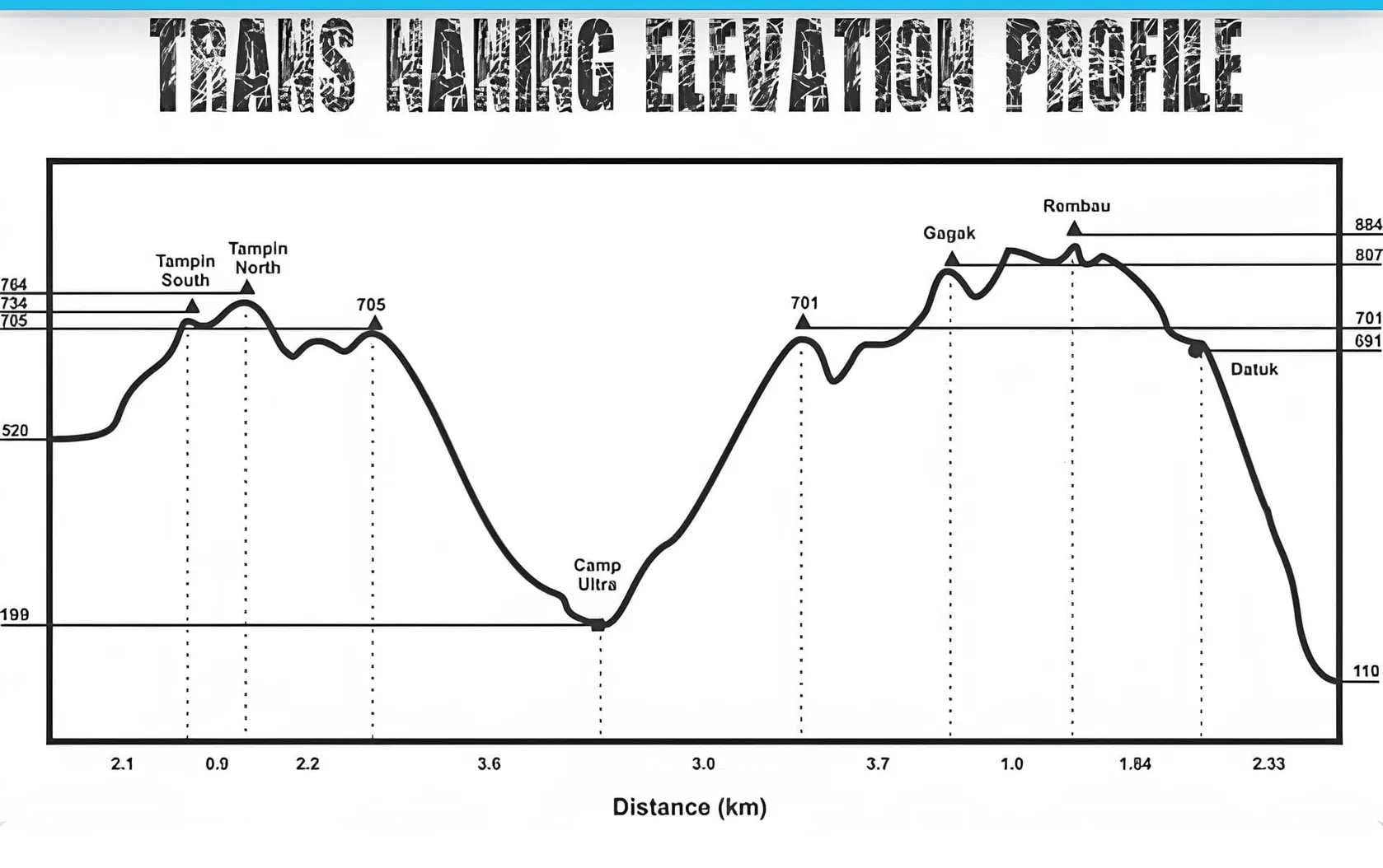
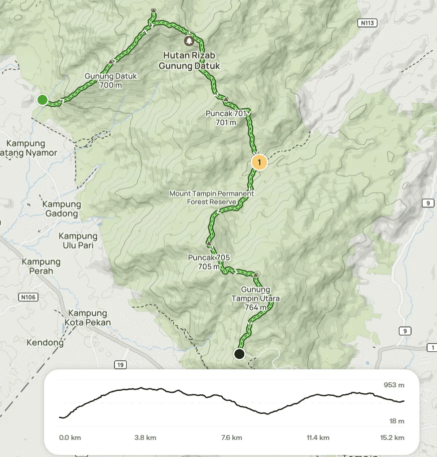
The full trail traverses seven peaks, namely Gunung Datuk > Gunung Rembau > Gunung Gagak > Puncak 701 > Puncak 705 > Gunung Tampin Utara > Gunung Tampin Selatan.
The route can be completed in either direction. The typical “Trans Naning” starts at Gunung Datuk and ends at Tampin, while the “Trans Naning Reverse” starts from the Tampin side
Hike Information:
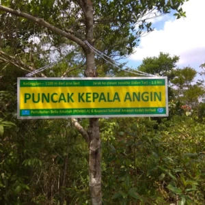
📍 Location: Rembau, Negeri Sembilan
📜 Permit: Mandatory
🧑✈️ Licensed MGP Guide: Mandatory
📏 Distance: ~ 17 km (One-Way)
⛰ Peak Height:
- Gunung Datuk – 855 m / 2,805 ft
- Gunung Rembau – 884 m / 2,900 ft
- Gunung Gagak – 807 m / 2,648 ft
- Puncak 701 – 701 m / 2,300 ft
- Puncak 705 – 705 m / 2,313 ft
- Gunung Tampin Utara – 764 m / 2,507 ft
- Gunung Tampin Selatan – 733 m / 2,405 ft
📈 Elevation Gain: ~ 1,800 m / 5,906 ft
⚠️ Difficulty Rating: 7/10 (Challenging)
📍 Peak Coordinates:
- Gunung Datuk – 2°33’07.4″N 102°10’58.1″E 👉 [View on Google Maps]
- Gunung Rembau – 2°33’43.2″N 102°11’26.3″E 👉 [View on Google Maps]
- Gunung Gagak – 2°33’20.2″N 102°12’01.5″E 👉 [View on Google Maps]
- Puncak 701 – 2°32’38.7″N 102°12’21.0″E 👉 [View on Google Maps]
- Puncak 705 – 2°30’55.1″N 102°12’07.1″E 👉 [View on Google Maps]
- Gunung Tampin Utara – 2°30’30.6″N 102°12’42.4″E 👉 [View on Google Maps]
- Gunung Tampin Selatan – 2°30’12.7″N 102°12’53.7″E 👉 [View on Google Maps]
👥 MGP Guide to Hiker Ratio:
- The standard MGP guide-to-hiker ratio is 1:7, but where guides are optional, the recommended ratio is 1:10.
- If your group has more than 7 or 10 participants, additional guides will be required to maintain the mandated safety ratio.
- This requirement ensures safety, compliance with forestry regulations, and a better hiking experience for all participants.
🔢 Ratio Examples:
- 1–7 hikers → 1 guide
- 8–14 hikers → 2 guides
- 15–21 hikers → 3 guides
- 22–28 hikers → 4 guides
💬 Next Steps After Payment:
- 📧 Confirmation: You’ll receive a booking confirmation within 10 minutes. If you don’t receive a confirmation email, please contact our customer support team.
- 📱 WhatsApp Group: All registered participants will be added to a dedicated WhatsApp group for final updates, reminders, and important hike information.
- 🎫 Voucher Type: Please present your mobile voucher along with your identification or passport on the day of the hike.
Tentative – Trans Naning via Gunung Datuk (Forward)
5:30 AM – Gather at Gunung Datuk parking 👉 [View on Google Maps]
6:00 AM – Safety briefing, gear check & warm-up
6:15 AM – Begin hike up Gunung Datuk
9:15 AM – Arrive at Gunung Datuk peak (photo stop)
10:00 AM – Continue to Gunung Rembau
11:00 AM – Checkpoint – Gunung Rembau
12:00 PM – Gunung Gagak
1:00 PM – Puncak 701
2:00 PM – Puncak 705 (Lunch / Rest)
3:00 PM – Continue to Gunung Tampin Utara
4:30 PM – Gunung Tampin Selatan
5:00 PM – Descent to exit point (Tampin trailhead)
6:00 PM – End of hike | dismissal
Notes:
- This tentative schedule is for guidance only and may change depending on actual conditions, including traffic delays, weather conditions, varying group pace, or delays by participants.
- All real-time updates and changes will be communicated through a designated WhatsApp group.
- Parking is free and available on-site.
Meeting Point
Gunung Datuk Entrance
Kampung Chengkau Ulu, 71350 Rembau, MY