Description
Background:
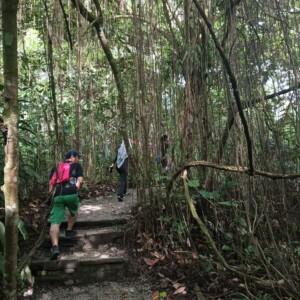
Gunung Machinchang is one of Langkawi’s most iconic and challenging hikes, offering a perfect blend of adventure, breathtaking scenery, and raw nature. As the island’s second-highest mountain, it sits within the Machinchang Cambrian Geoforest Park, part of a UNESCO Global Geopark known for its ancient rainforests and dramatic geological formations.
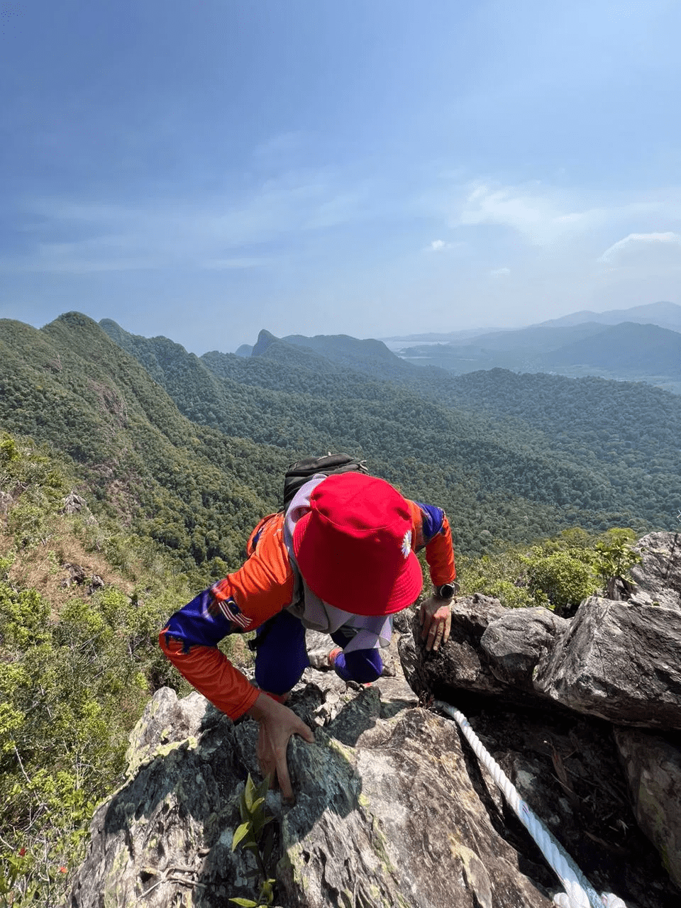
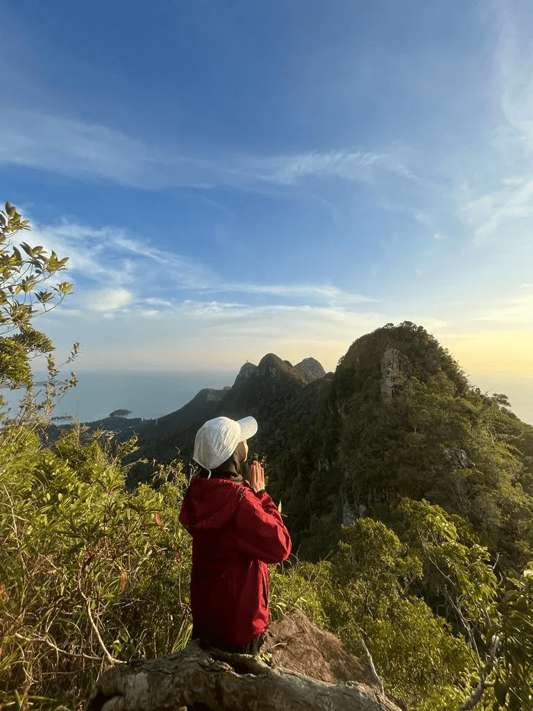
The hike ranges from moderate to challenging, taking you through dense jungle trails, steep inclines, rocky terrain, and rope-assisted sections near the summit. Along the way, hikers are immersed in lush rainforest landscapes and may spot wildlife such as monkeys and tropical birds. Upon reaching the peak, you’re rewarded with spectacular panoramic views of Langkawi’s coastline, the Andaman Sea, surrounding islands, and on clear days, even southern Thailand.
With multiple routes available—including the Legend Trail, Trail 701, and access via the SkyCab area. Gunung Machinchang offers a rewarding experience for hikers seeking both challenge and unforgettable views in one of Langkawi’s most remarkable natural settings. After the hike, you can relax and cool off with a refreshing dip in the natural pools at Seven Wells.
Hike Information:
📍 Location: Langkawi, Kedah
📜 Permit: Mandatory
🧑✈️ Licensed MGP Guide: Mandatory
📏 Distance: ~ 12 km (Return)
⛰ Peak Height: 656 m / 2,152 ft
📈 Elevation Gain: ~ 600 m / ~ 1,968 ft
⚠️ Difficulty Rating: 7/10 (Challenging)
📍 Peak Coordinates: 6°23’13.1″N 99°39’39.8″E 👉 [View on Google Maps]
👥 MGP Guide to Hiker Ratio:
- The standard MGP guide-to-hiker ratio is 1:7.
- If your group has more than 7 participants, additional guides will be required to maintain the mandated safety ratio.
- This requirement ensures safety, compliance with forestry regulations, and a better hiking experience for all participants.
🔢 Ratio Examples:
- 1–7 hikers → 1 guide
- 8–14 hikers → 2 guides
- 15–21 hikers → 3 guides
- 22–28 hikers → 4 guides
💬 Next Steps After Payment:
- 📧 Confirmation: You’ll receive a booking confirmation within 10 minutes. If you don’t receive a confirmation email, please contact our customer support team.
- 📱 WhatsApp Group: All registered participants will be added to a dedicated WhatsApp group for final updates, reminders, and important hike information.
- 🎫 Voucher Type: Please present your mobile voucher along with your identification or passport on the day of the hike.
Tentative – Gunung Machinchang
7:30 AM – Assemble at Jalan Telaga Tujuh Parking👉 [View on Google Maps]
7:45 AM – Registration, gear check & permit verification
8:00 AM – Safety briefing, gear check & warm-up
8:15 AM – Start hike
10:30 AM – Checkpoint / short rest break
12:00 PM – Estimated arrival at summit (Rest, photos & enjoy panoramic views)
12:45 PM – Begin descent
2:30 PM – Estimated arrival back at trail exit
2:30 – 3:00 PM – Refreshing dip at Seven Wells Waterfall & cool down
3:00 PM – End of hike & dismissal
Notes:
- This tentative schedule is for guidance only and may change depending on actual conditions, including traffic delays, weather conditions, varying group pace, or delays by participants.
- All real-time updates and changes will be communicated through a designated WhatsApp group.
- Parking is available on-site.
Meeting Point
Parking Jalan Telaga Tujuh
Jalan Telaga Tujuh, 07000 Langkawi, MY