
Description
Background:
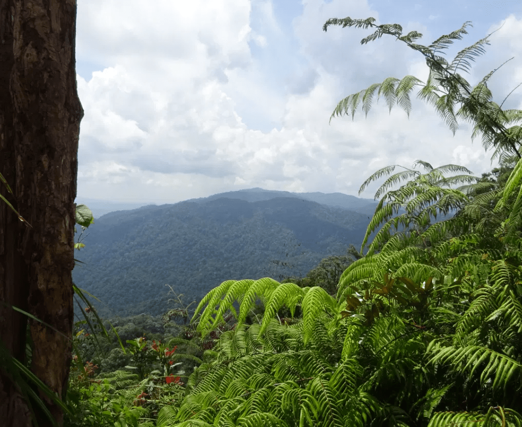
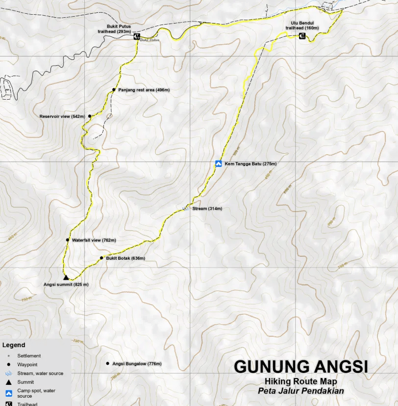
Gunung Angsi Circle offers one of Negeri Sembilan’s most rewarding day hikes, combining the popular Bukit Putus ascent with a scenic descent via Ulu Bendul. Just about an hour from Kuala Lumpur, this third-highest peak in the state features rich colonial-era history, lush forest trails, and a steady climb suitable for both new and experienced hikers.
This circular route allows hikers to experience the best of both trails in a single journey — ascending through the well-established Bukit Putus path before descending into the serene surroundings of Ulu Bendul Recreational Park. With varied terrain, clear trails, and a satisfying summit experience, Gunung Angsi Circle is perfect for beginners seeking a more complete and adventurous hiking experience in Negeri Sembilan.
Hike Information:
📍 Location: Kuala Pilah, Negeri Sembilan
📜 Permit: Mandatory
🧑✈️ Licensed MGP Guide: Optional for Malaysian Citizen / Mandatory for Non-Malaysian Citizen
📏 Distance: ~ 15 km (loop)
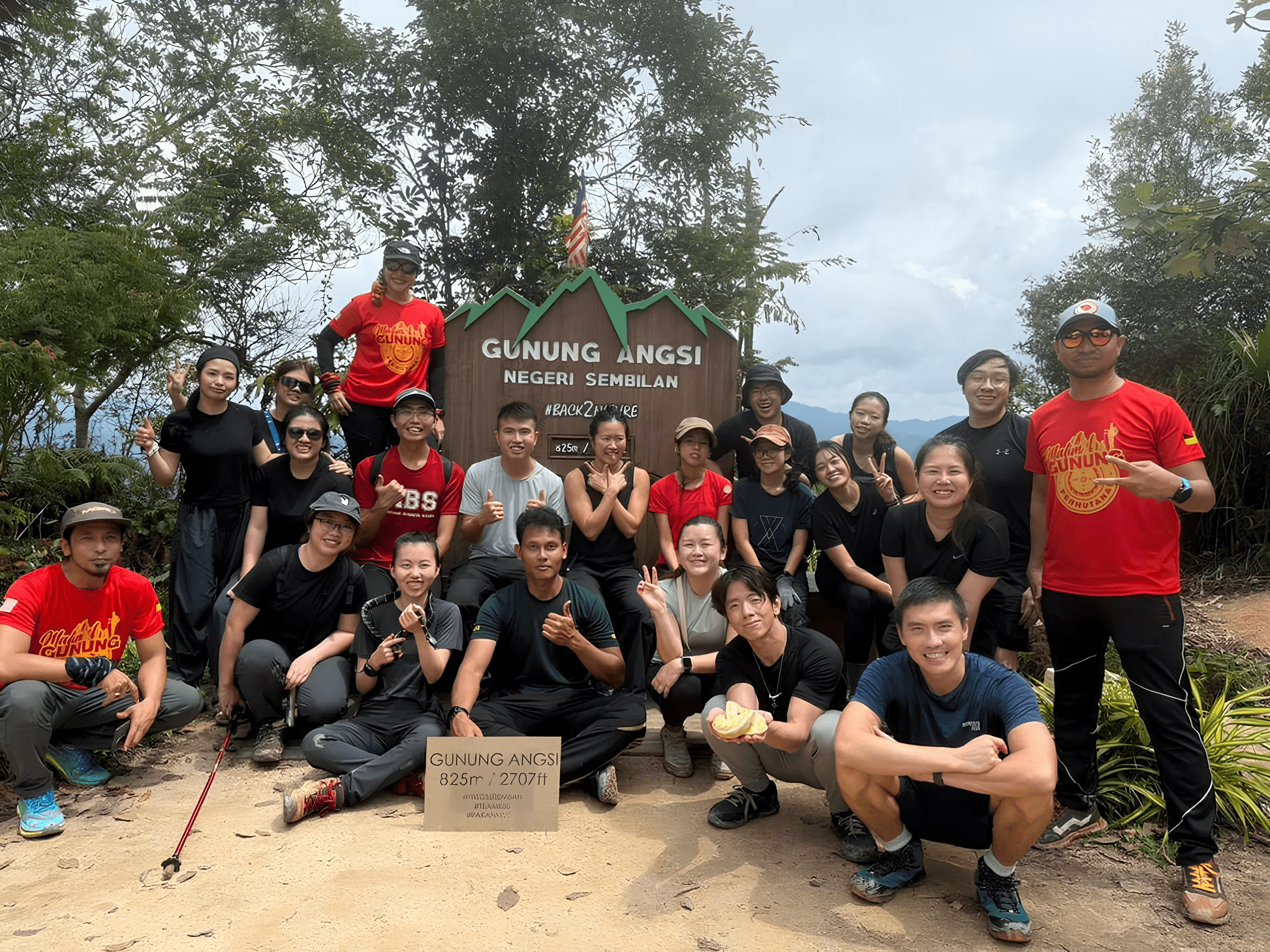
⛰ Peak Height: 825 m / 2,707 ft
📈 Elevation Gain: ~ 800 m / ~ 2,624 ft
⚠️ Difficulty Rating: 4/10 (Moderate)
📍 Peak Coordinates: 2°41’55.3″N 102°02’52.8″E 👉 [View on Google Maps]
👥 MGP Guide to Hiker Ratio:
- The standard MGP guide-to-hiker ratio is 1:7, but where guides are optional, the recommended ratio is 1:10.
- If your group has more than 7 or 10 participants, additional guides will be required to maintain the mandated safety ratio.
- This requirement ensures safety, compliance with forestry regulations, and a better hiking experience for all participants.
🔢 Ratio Examples (1:7):
- 1–7 hikers → 1 guide
- 8–14 hikers → 2 guides
- 15–21 hikers → 3 guides
- 22–28 hikers → 4 guides
🔢 Ratio Examples (1:10):
- 1–10 hikers → 1 guide
- 11–20 hikers → 2 guides
- 21–30 hikers → 3 guides
💬 Next Steps After Payment:
- 📧 Confirmation: You’ll receive a booking confirmation within 10 minutes. If you don’t receive a confirmation email, please contact our customer support team.
- 📱 WhatsApp Group: All registered participants will be added to a dedicated WhatsApp group for final updates, reminders, and important hike information.
- 🎫 Voucher Type: Please present your mobile voucher along with your identification or passport on the day of the hike.
Tentative – Gunung Angsi Circle
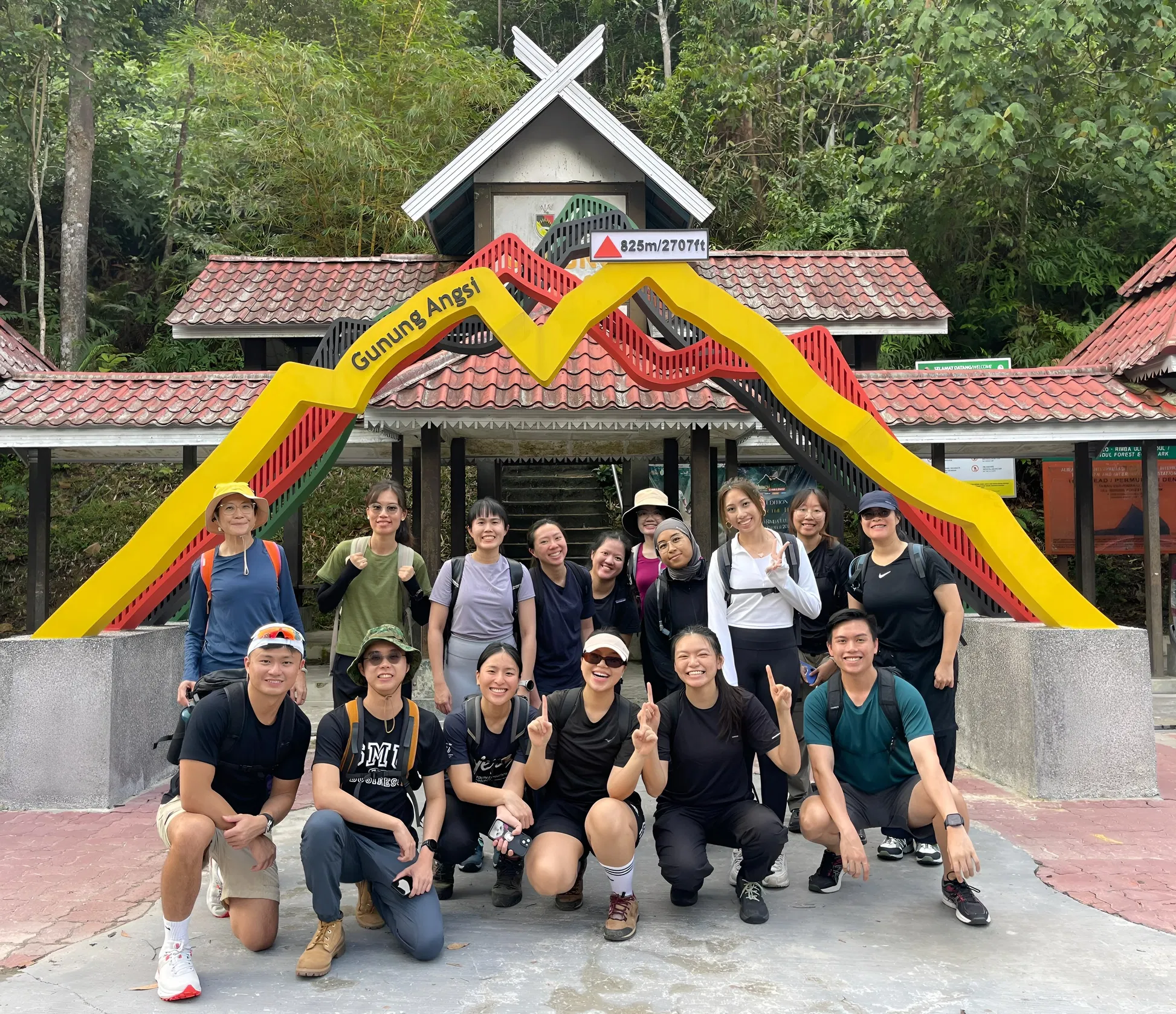
8:00 AM – Assemble at Bukit Putus Trailhead 👉 [View on Google Maps]
8:30 AM – Safety briefing, gear check & warm-up
8:45 AM – Begin hike via Bukit Putus Trail (ascent)
10:30 AM – Short rest stop / hydration break
12:30 PM – Arrive at Gunung Angsi Summit (825m) | Lunch break | Free time & photos
1:15 PM – Begin descent via Ulu Bendul Trail (complete the circle route)
3:00 PM – Short rest stop / regroup
4:30 PM – Arrive at Ulu Bendul Recreational Park
5:00 PM – Arrive at Bukit Putus Trailhead | End of hike
Notes:
- This tentative schedule is for guidance only and may change depending on actual conditions, including traffic delays, weather conditions, varying group pace, or delays by participants.
- All real-time updates and changes will be communicated through a designated WhatsApp group.
- Parking is free and available on-site.
Meeting Point
Bukit Putus (Gunung Angsi Trailhead)
Jalan Kuala Pilah, 72009 Kuala Pilah, MY