
Description
Background:
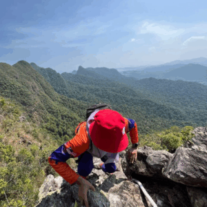
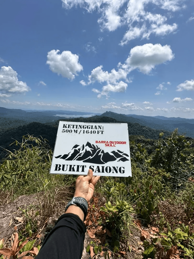
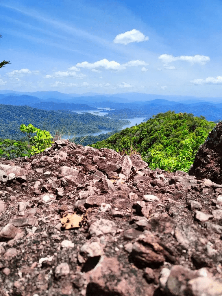
Discover one of the most prominent geological landmarks in the Ulu Muda region: Bukit Saiong. Located in the remote wilderness of Gubir, this peak offers more than just a challenging climb—it is a rare journey through both time and geography.
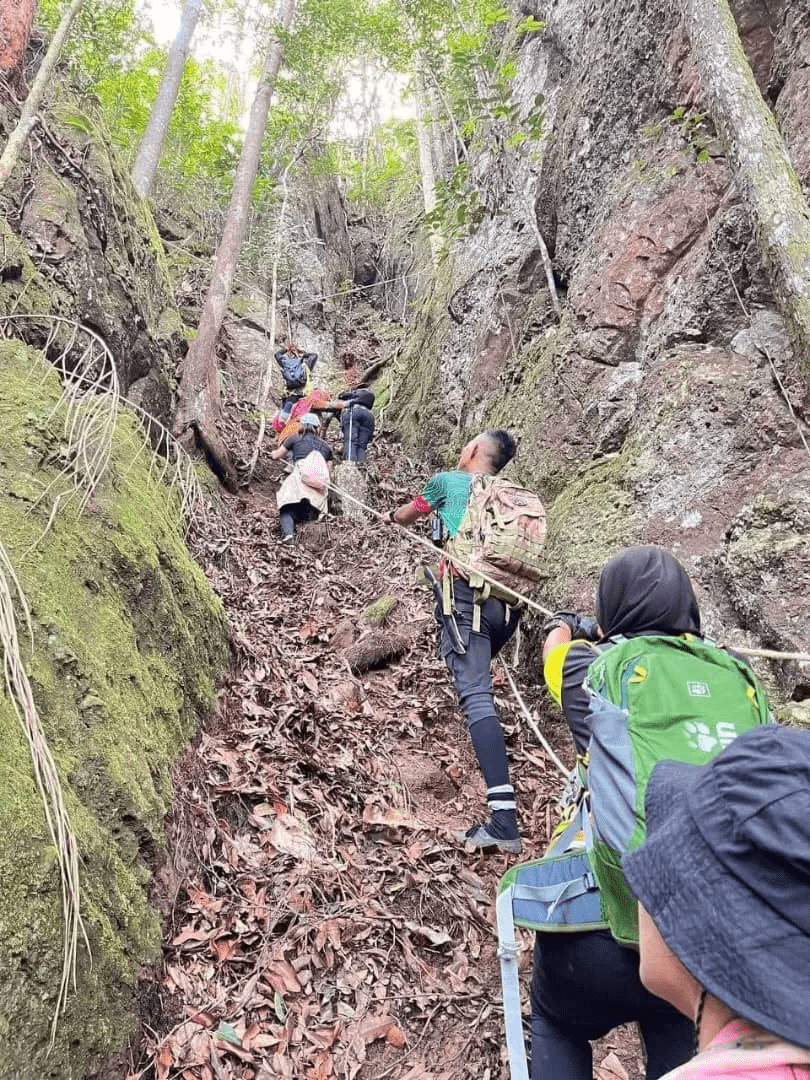
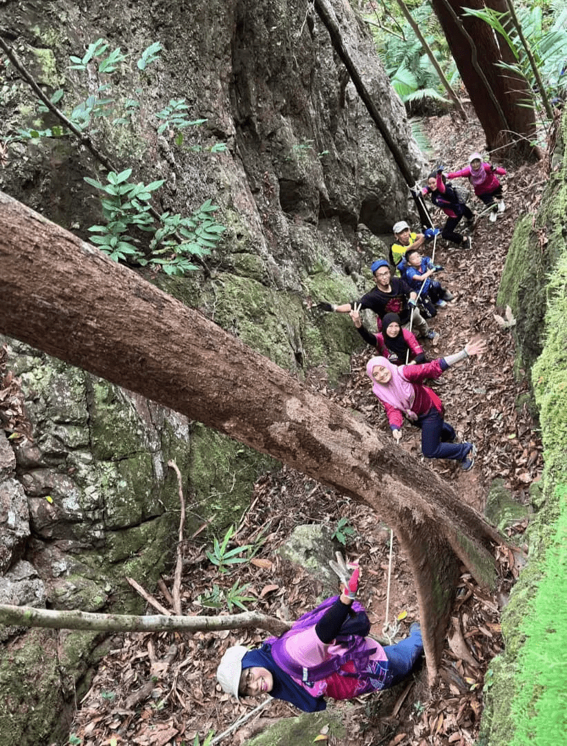
The experience begins with the very ground beneath your boots. You will walk upon ancient sedimentary rock formations that belong to the Saiong Formation, dating back to the Jurassic and Cretaceous periods. These rocks were formed between 81 and 150 million years ago, making this trail a literal walk through prehistoric history.
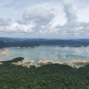
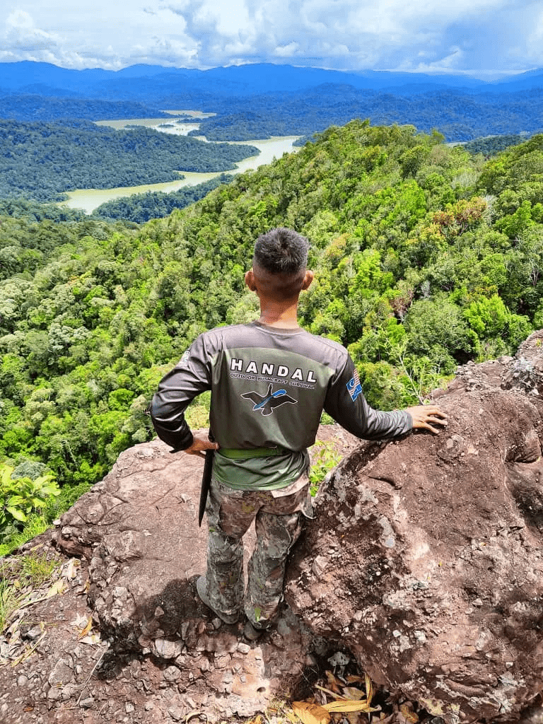
Beyond its age, Bukit Saiong is a geographical marvel. This unique sandstone ridge serves as a majestic natural barrier that separates two of the region’s most famous water bodies: Lake Pedu and Lake Muda. As you ascend, you are trekking along a natural international border that divides Malaysia and Thailand, situated just east of the Lake Pedu area.
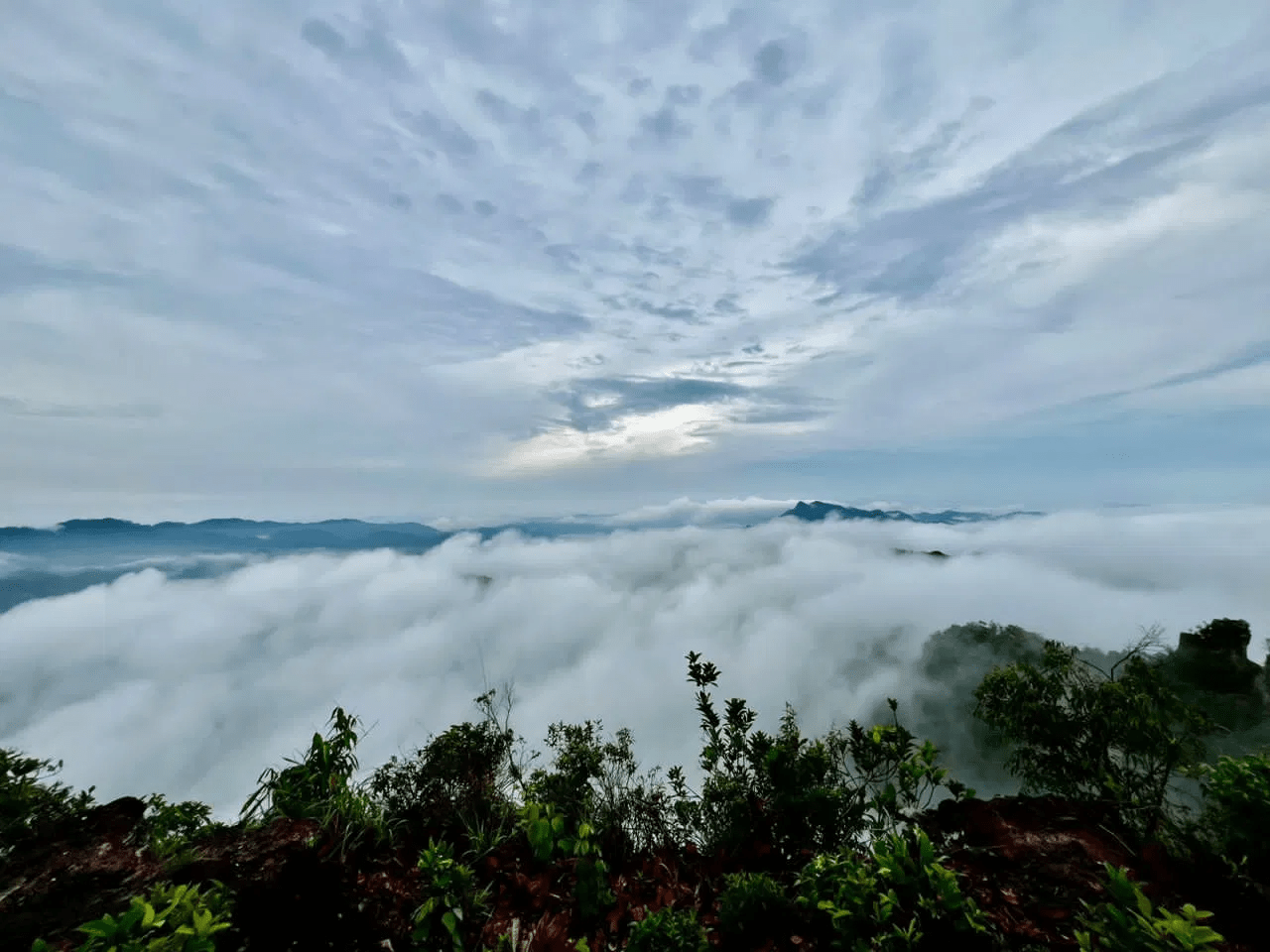
The summit itself stands as an iconic landmark, visible from the distant waters of Lake Muda and waiting for you to conquer it.
Hike Information:
📍 Location: Gubir, Sik Kedah
📜 Permit: Mandatory
🧑✈️ Licensed MGP Guide: Mandatory
📏 Distance: ~ 8 km (Return)
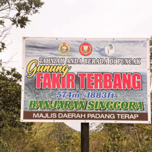
⛰ Peak Height: 500 m / 1,640 ft
📈 Elevation Gain: ~ 900 m / ~ 2,953 ft
⚠️ Difficulty Rating: 4/10 (Moderate)
📍 Peak Coordinates: 6°08’00.9″N 100°51’60.0″E 👉 [View on Google Maps]
👥 MGP Guide to Hiker Ratio:
- The standard MGP guide-to-hiker ratio is 1:7.
- If your group has more than 7 participants, additional guides will be required to maintain the mandated safety ratio.
- This requirement ensures safety, compliance with forestry regulations, and a better hiking experience for all participants.
🔢 Ratio Examples:
- 1–7 hikers → 1 guide
- 8–14 hikers → 2 guides
- 15–21 hikers → 3 guides
- 22–28 hikers → 4 guides
💬 Next Steps After Payment:
- 📧 Confirmation: You’ll receive a booking confirmation within 10 minutes. If you don’t receive a confirmation email, please contact our customer support team.
- 📱 WhatsApp Group: All registered participants will be added to a dedicated WhatsApp group for final updates, reminders, and important hike information.
- 🎫 Voucher Type: Please present your mobile voucher along with your identification or passport on the day of the hike.
Tentative – Bukit Saiong
7:00 AM – Assemble at Tasik Gubir Sik parking 👉 [View on Google Maps]
7:15 AM – Depart to starting point
7:30 AM – Safety briefing, gear check & warm-up
7:45 AM – Start hike
10:00 AM – Estimated arrival at the peak (rest, photos, enjoy the view)
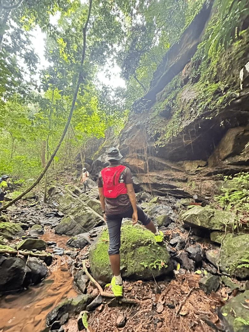
12:30 PM – Begin descent from the peak (stop by Sang Kelembai Foot Pool)
2:00 PM – Estimated arrival at parking area & dismissal
Notes:
- Try to complete any mobile phone communication beforehand, as mobile line coverage is not satisfactory around the parking area.
- This tentative schedule is for guidance only and may change depending on actual conditions, including traffic delays, weather conditions, varying group pace, or delays by participants.
- All real-time updates and changes will be communicated through a designated WhatsApp group.
- Parking is free and available on-site.
Meeting Point
Pengkalan Rekreasi Tasik Gubir
Pengkalan Gubir (Sik, Kedah), 08210 Sik, MY